 vesseltracker.com
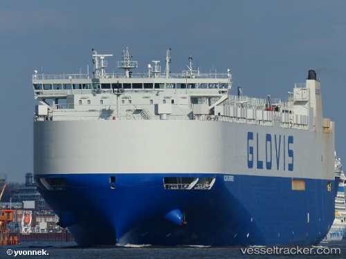
Vessel GLOVIS SUPREME IMO: 9674177, MMSI: 441133000 vehicle carrier RO-RO
UTC, 14.08531, 114.51709, course: 216, speed: 17.1
UTC, 13.18438, 113.77858, course: 218, speed: 16.6
UTC, 12.96676, 113.59866, course: 218, speed: 17.2
UTC, 12.91490, 113.55666, course: 219, speed: 16.9
2026-01-23 21:39:14 UTC, 12.42793, 113.15469, course: 218, speed: 18.2
Live AIS position:
UTC. 210 nm E of Tan Cang Qui Nhon),
updated 2026-01-23 21:39:14 UTC.
Find the position of the vessel GLOVIS SUPREME on the map. The latter are known coordinates and path.
marine traffic ship tracker show on live map
The current position of vessel GLOVIS SUPREME is 12.42793 lat / 113.15469 lng. Updated: 2026-01-23 21:39:14 UTCCurrently sailing under the flag of Korea
GLOVIS SUPREME built in 2013 year
Deadweight:
20138 tDetails:
Last coordinates of the vessel:
UTC, 14.09280, 114.52300, course: 216, speed: 16.8UTC, 14.08531, 114.51709, course: 216, speed: 17.1
UTC, 13.18438, 113.77858, course: 218, speed: 16.6
UTC, 12.96676, 113.59866, course: 218, speed: 17.2
UTC, 12.91490, 113.55666, course: 219, speed: 16.9
2026-01-23 21:39:14 UTC, 12.42793, 113.15469, course: 218, speed: 18.2